IIT Madras: Researchers at the Indian Institute of Technology Madras (IIT Madras) have developed an innovative real-time indoor mapping application known as “UbiqMap”. Accurate maps can be generated in all lighting and environmental conditions without heavy reliance on existing infrastructure.
As per the official press release, UbiqMap employs Radio Tomographic Imaging (RTI), an approach that internalizes variations in radio signal intensity caused by obstructions to create identified maps. Well-established RTI systems require a collection of fixed wireless transceivers to monitor these signal variations. On the other hand, UbiqMap’s wearable transceivers are scalable. These devices periodically update the floor map based on the locations of team members as they move around it, so it provides an accurate and up-to-date layout of the space at all times.
During relief operations, when traditional infrastructure might be unavailable or untrustworthy, emergency responders will especially benefit from this dynamic and portable approach, which does not require pre-installed infrastructure.
Assistant Professor Dr. Ayon Chakraborty of IIT Madras’ Department of Computer Science and Engineering oversaw this study. Mr. Amartya Basu, an MS student at IIT Madras, and Mr. Kush Jajal, an M.Tech student at IIT Madras, were also members of the research team. The IIT Madras Research Team has submitted an Indian patent application for this technique.
While talking about this, Dr Ayon Chakraborty, said, “Public safety incidents, particularly search and rescue operations, are often hindered by lack of accurate and up-to-date indoor building plans. Even when maps are available, they typically fail to capture real-time dynamics essential for effective mission planning during disasters. Our technology offers first responders a robust and portable tool to image indoor environments without dependence on visual line of sight or extensive computational resources, making it an invaluable asset in complex, time-critical scenarios.”
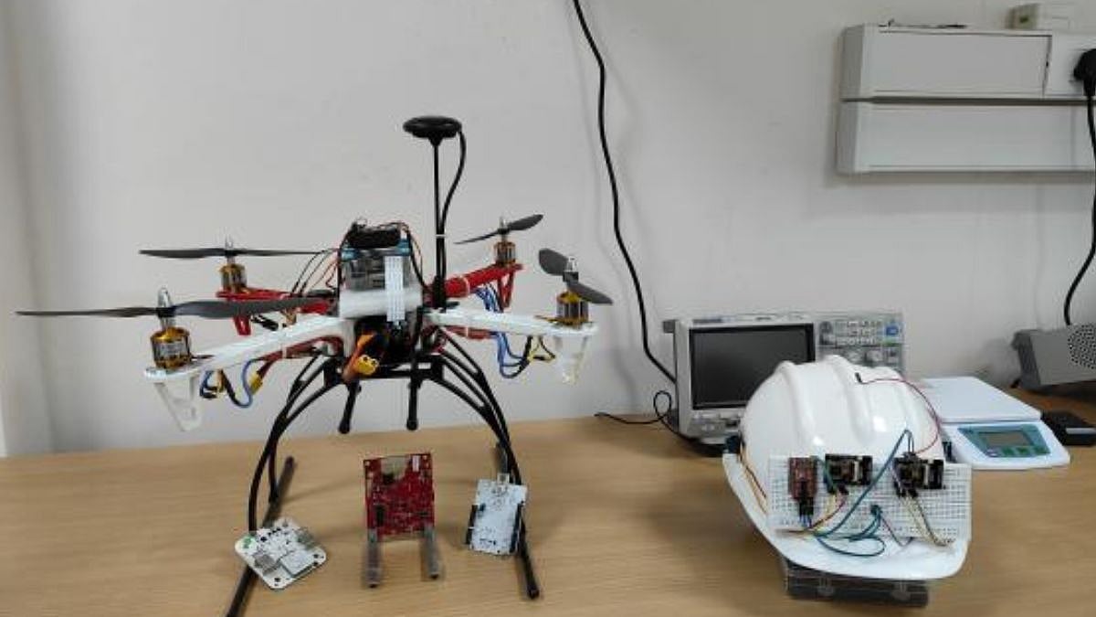
He further added, “We have successfully tested the technology in a controlled setup within a few residential units at IITM campus. These trials allowed us to validate the system’s functionality, though the movement and localization of the transceivers were carefully managed during the tests. An important ongoing focus is optimizing the choice of wireless frequency. This involves balancing better indoor penetration with higher imaging resolution—an essential tradeoff in the design of wireless sensing systems. Additionally, we are integrating UbiqMap with visual modalities using sensor fusion. Currently, we are in the process of prototyping a wearable version of the technology to prepare for field trials in real-world scenarios.”
IIT Madras’s larger initiatives to further research in autonomous systems and mobile sensing include the creation of UbiqMap. The organization has worked on projects of scene understanding for detecting hidden geolocations and algorithms for planning and control of autonomous systems.
One sector where this advancement is expected to make a significant difference in public safety because first responders would be able to utilize exact indoor maps in an emergency. Moreover, providing real-time and complete indoor layouts can enhance facility management productivity.
The IIT Madras team plans to collaborate with industry partners to enhance the technology and explore its commercialisation prospects. In the future, this development might extend the system to work in dynamic environments and connect with existing building management systems.